Carrizo Plain National Monument in eastern San Luis Obispo County is one of California’s most iconic wildflower viewing areas, but is this year’s display worth the 150-mile drive from L.A.?
If you’re looking for blankets of bright color covering the hills, the answer is no.
But if you want a beautiful outing with boundless sky, close encounters with birds, Indigenous and geologic history and undulating waves of grass punctuated by splotches of gold, violet and orange, then definitely yes — but wait a good week or more for the muddy roads to become passable again.
In early March, a friend and I planned our visit for April 14, largely because the rainy season is typically over by the end of March, peak bloom is typically in early April, and given this spring’s cool temperatures, we figured the weather would have warmed by then to encourage a good display. But the first two weeks of April brought plenty of chilly showers to much of Central and Southern California, and during our visit, the temperatures hovered in the mid-50s, and the rain waxed and waned between hopeful moments of blue sky followed by black clouds and water falling in curtains.
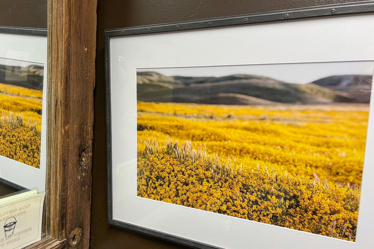
The best wildflower display was in a large photo from 2019 of goldfields carpeting a valley hanging in the bathroom of the Cuyama Buckhorn restaurant in New Cuyama.
(Jeanette Marantos / Los Angeles Times)
Truth be told, the best wildflower display we saw during our visit was a 2019 photograph in the restroom of the Cuyama Buckhorn restaurant in New Cuyama — a stunning view of California goldfields (Lasthenia californica) growing so vast in the Carrizo Plain during a superbloom that they looked like a golden carpet stretching for miles.
Truth be told, the best wildflower display we saw during our visit was a 2019 photograph in the restroom of the Cuyama Buckhorn restaurant.
We did see swaths of goldfields during our soggy trip, along with armies of brown sodden tumbleweeds and pockets of other wildflowers, such as purple owl’s clover (Castilleja exserta), which are actually violet; yellow and white common tidy tips (Layia platyglossa); and (rarely) California poppy (Eschscholzia californica). But the most prominent color was the bright green of California’s hills after a rainy spring.
The tall grass was thick and ripply, like wind on water, and often erupted with birds that flew alongside our car and sometimes outpaced us because Soda Lake Road, the lone paved road, was pocked with gaping potholes and puddles of concerning depth.
A superbloom? Not then and probably not this year, according to the rangers at the Goodwin Education Center at Carrizo Plain. The sign behind the front counter told the story. The last three superbloom years — when wildflowers bloomed so densely that they formed quilts of color over the hills — were in 2017, 2019 and 2023, the rangers said, when the region’s rainfall from Oct. 1 to Sept. 30 had, respectively, been 12.29 inches, 16.31 inches and 15.32 inches. So far, the rainfall for 2024’s water year is less than 10 inches — including the unseasonable rain falling April 14 — and more rain this season is not expected.
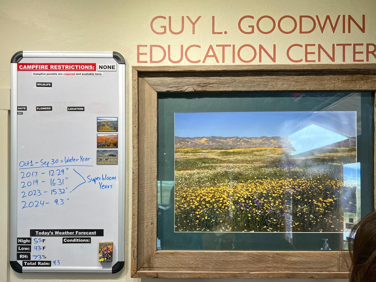
The sign in the Guy L. Goodwin Education Center shows that the Carrizo Plain’s rainfall this year has been less than in past years with “superblooms” that carpeted the hills.
(Jeanette Marantos / Los Angeles Times)
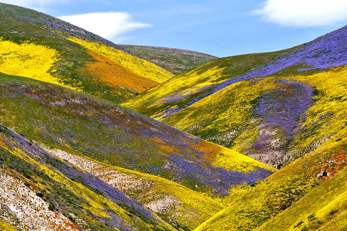
The Carrizo Plain superbloom on April 16, 2017.
(Raul Roa / Los Angeles Times)
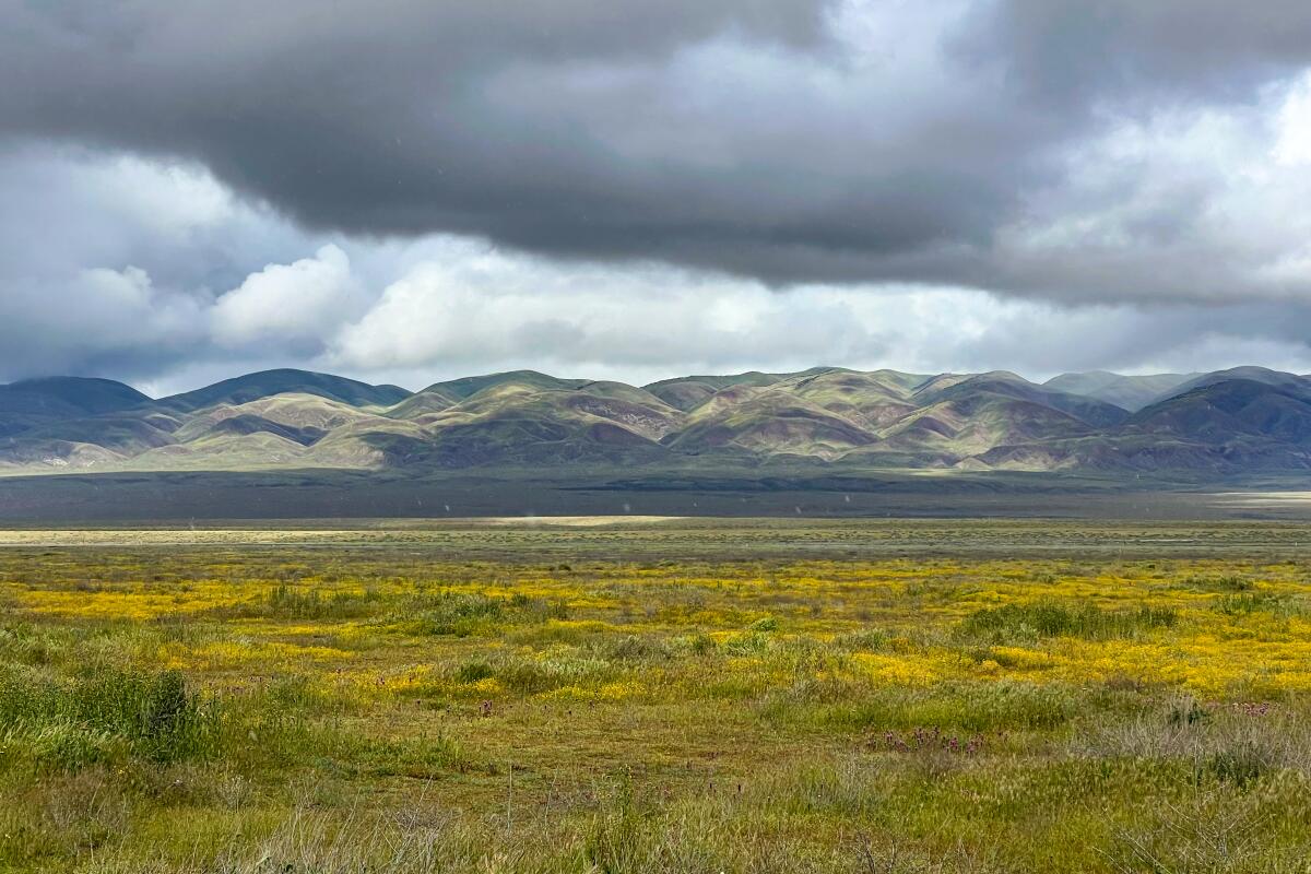
Scenes of the Carrizo Plain on April 14, 2024 during a drive on the paved portion of Soda Lake Road in Carrizo Plain National Monument in San Luis Obispo County. These days, the plain consists primarily of grasses, with sporadic color.
(Jeanette Marantos / Los Angeles Times)
The Carrizo Plain stretches 50 miles between the Temblor and Caliente mountains, a grassy plain and drainage basin where Chumash, Yokuts and other Indigenous peoples hunted and traded before settlers tried their hand at dryland farming. There are a few campgrounds, trails and unpaved roads, but no services (such as gas, water, food and, usually, cell). The temperatures often exceed 100 degrees in the summer and dip down to freezing during the winter, according to the brochure. All but one of the roads, Soda Lake Road off Highway 58, are unpaved, and even Soda Lake Road becomes an unpaved, rutted road five miles south of the Goodwin Education Center, which features restrooms and picnic tables, along with books, gifts and exhibits.
Besides birding, camping, hiking and wildflower peeping, you can walk along the San Andreas Fault on the Wallace Creek trail, wander on a platform trail along Soda Lake, which becomes a “dry, salt-encrusted basin during the dry season,” according to the brochure, and study the pictographs left by Native peoples on Painted Rock, which this time of year can be visited only with ranger guides on Saturdays (reservations required).
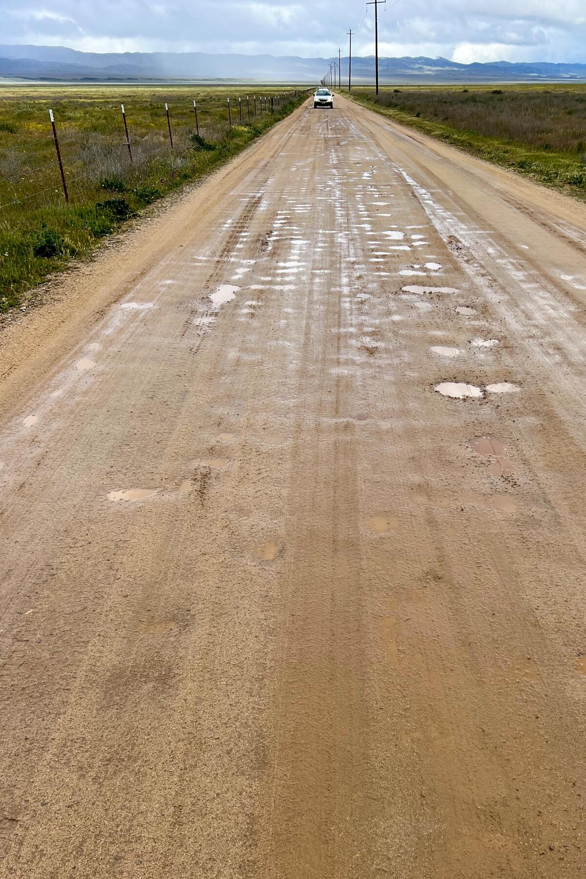
It poured rain much of the day, and the nonpaved roads were mostly impassable, except for a short road to the visitor center.
(Jeanette Marantos / Los Angeles Times)
But on Sunday, we couldn’t do any of that because the muddy, unpaved roads were so impassable that even tow trucks were getting stuck, according to rangers. Every few minutes, someone came into the center and asked the same question — is it safe to keep driving south on Soda Lake Road once the pavement ends? And every time, the rangers patiently answered that they definitely wouldn’t recommend any of the unpaved roads for two-wheel-drive cars, or even four-wheel-drive SUVs, unless they had high clearance, nerves of steel and enough money to pay for a tow truck.
The few that braved the back roads drove brawny vehicles that looked like they’d been sloppily dipped into chocolate. As my friend and I wavered about what to do, we spoke with two people who had made the drive. They had a kind of hysterical look and emphatically told us not to try, even though my Toyota Highlander SUV has four-wheel drive. “I can’t believe we made it,” said one wide-eyed woman in a large pickup with mud caked halfway up its windshield. “You’d never get through.”
A few hearty souls were walking in the rain on the platform trail along Soda Lake, but the tiny parking area had so many muddy ruts and puddles that we decided to avoid that too, lest we get stuck. Instead, I grumpily drove back north to California 58 — even though I hate backtracking — and headed east. Our mood quickly improved along this spectacular winding drive through what looked like the verdant, tree-dappled Shire in the Lord of the Rings.
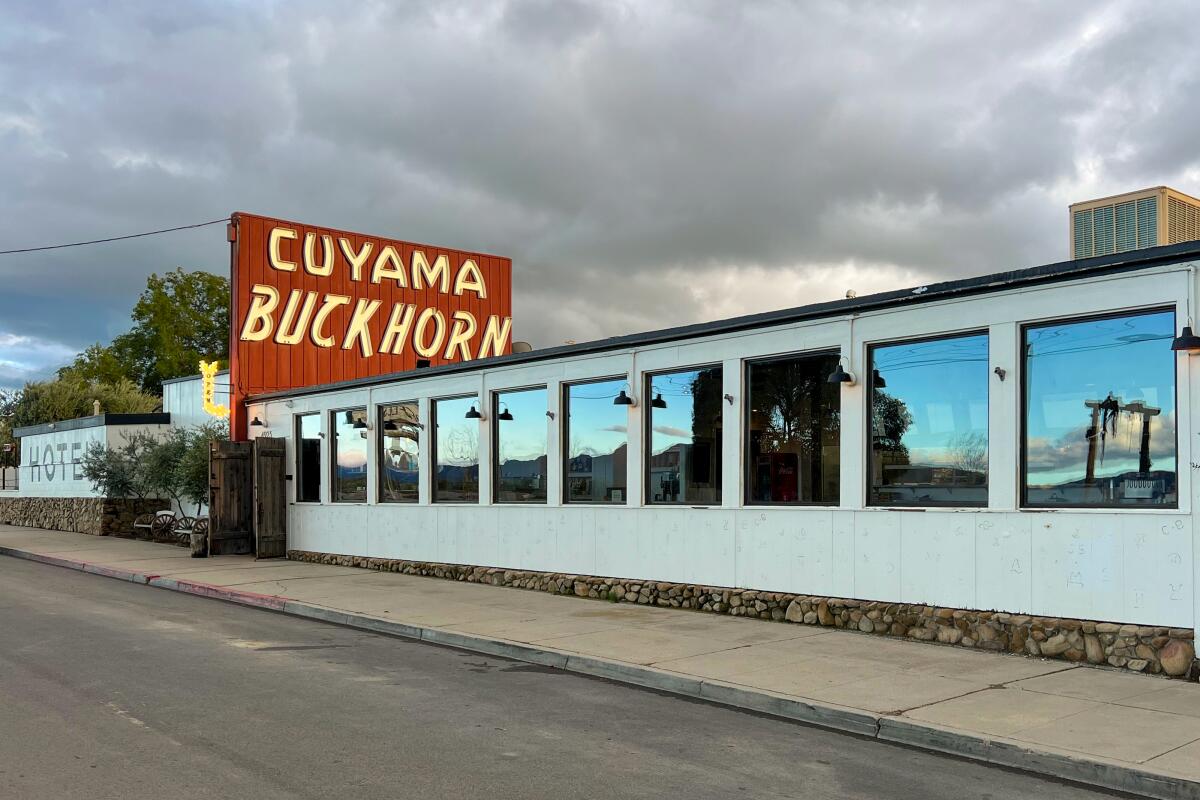
The Cuyama Buckhorn restaurant in New Cuyama. Order the smoked oyster mushroom tacos and check out the bathroom for a gorgeous 2019 superbloom photo.
(Jeanette Marantos / Los Angeles Times)
After our lovely drive south on 58, we turned west on California 33 near McKittrick, and within a few miles entered a hellscape of bobbing oil pumps and acres of power poles and wires between Derby Acres and Taft. Our destination was New Cuyama for a late lunch-early dinner at the Cuyama Buckhorn restaurant on California 166, which runs along the western border of the Carrizo Plain. I heartily recommend this restaurant, which despite its tiny town locale has a sophisticated, upscale bar, wine list and menu (the smoked oyster mushroom tacos with tender blue-corn tortillas — made at the restaurant — are to die for), along with a remodeled hotel.
And when we were done, the clouds were parting, luckily, because our final leg took us west through Los Padres National Forest on California 33, a scenic but winding road where earlier rain had washed out several spots, so we had to stop frequently to wait for a green light to travel along single lanes. The going was beautiful but slow and a little hair-raising as day turned to night.

